
Blue Ridge Parkway May 2010
We took an extended weekend trip to Boone, NC so that we could do some hikes off the Blue Ridge Parkway. Similar to the trip last year where we wanted to focus on areas directly off the parkway we found tons of stuff to see. The basic plain this time was to stay at a bed and breakfast off the parkway near Boone. Day 1 we would drive about an hour south and then work our way back hitting all of the hiking spots we could fit in. On Day 2, we would do the same but head North.
The Two book we got that I can recommend are "Best Easy Day Hikes Blue Ridge Parkway", Falcon Guide and "Hiking the Blue Ridge Parkway" Randy Johnson Falcon Guide.
Thanks to Vicky and Randy for inviting us along. They have a group of friends with motorcycles that all ride together that were renting the entire bed and breakfast with the group. They had an extra room and invited us along. They were a fun group of people and it sounded like they had a blast riding while we were out hiking. Our mutal friend Teresa was also not a biker, and so went with Louise and I over hill and dale.
The Best
 |
 |
|
 |
 |
 |
Everything on the Parkway is measured by Parkway Mile Marker. They start at 0 at the beginning of the Parkway in Virgina and end at 469 in North Carolina. It is a little difficult to get used to the numbers increasing as you go south, but since work on the parkway began in 1935 it predates the interstate convention of increasing in milepost number as you go north.
| Milepost | Location |
| 241.1 | Bluff Mountain Trail (Doughton Park) |
| 241.1 | MTS Lodge Trail (Doughton Park) |
| 241.1 | Wildcat Rocks Overlook (Doughton Park) |
| 241.1 | Fodder Stack Trail (Doughton Park) |
| 264.4 | The Lump Overlook |
| 276.4 | US 421 to Boone (N) |
| 276.4 | US 321/221 to Boone (N) and Blowing Rock (S) |
| 302.8 | Rough Ridge (Tanawha Trail) |
| 304.4 | Lineville Viaduct Trail (Tanawha Trail) |
| 305.2 | Beacon Heights Trail |
| 316.4 | Linville Falls Trail |
Bluff Mountain Trail (Milepost 241.1, Doughton Park)
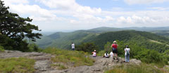
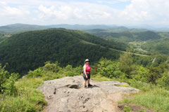
Part of the Doughton Park Recreation Area. If you start from the alternate trail head at the end of the picnic area, its just a short 10m min stroll to the top. Fantastic Views. Picture 1, is actually a picture looking acroos the parking lot at the MTS Lodge Trail, but this trail looks the same from that side.
 |
 |
 |
 |
 |
MTS Lodge Trail (Milepost 241.1, Doughton Park)
It is strange that this trail was not on any of the guides. Officially its part of the MTS (Mountains To the Sea) trail. In practice it links the Parking lot area and alternate trail head to the Bluff Mt Trail to the Bluffs Lodge & Restaurant. A Wonder full short walk. Great views in all directions. Very different from the normal blue ridge parkway hike in the trees, this one is basically a mowed path in a large file of grass.
 |
 |
 |
 |
 |
 |
Wildcat Rocks Overlook (Milepost 241.1, Doughton Park)
Note really a hike, but a short walk to a great overlook. You can just see one of the historic cabins inside the park boundaries, but it looks like a long hike down (and even longer hike up) to me.
 |
 |
 |
Fodder Stack Trail (Milepost 241.1, Doughton Park)
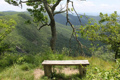
The Only time the guide book let me down. I don't know how this trial is listed in the "best of", much less what crazy person recommends it for families. This was the only view of note and it was in the first 5 minutes. After that, the entire hike was in the trees with no views. Avoid.
 |
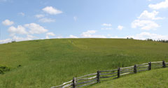
The Lump Overlook(Milepost 264.4)
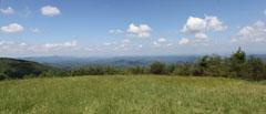
A Big clear Grassy Hill, and a great place for a picnic. There is one picnic table, but its at the bottom of the hill so why bother. Take a blanket and a hat and walk to the top and have a wonder view while eating lunch.
 |
 |
Rough Ridge (Tanawha Trail) (Milepost 302.8)
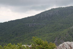
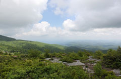
The Guide Book says "quite possibly the Parkways easiest path to a spectacular view" and they were not wrong. The area on the Ridge is considered a fragile ecosystem due to having only a thin coat of soil over the rock. The park server built a wooden walkway to keep hiker impact to a minimum. Thankfully they do not put up a barrier to a rock lip that lets you dangle your feet into mid air if you have the stomach for it. Not only do you have a great view of the valley but its one of the better views of the Linville Viaduct. This trail is a section of the longer Tanawha Trail which is almost 13 miles one way.
 |
 |
 |
 |
 |
 |
 |
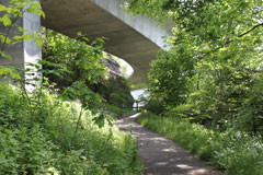
Linville Viaduct Trail (Tanawha Trail) (Milepost 304.4)
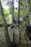
At the Linville Viaduct Visitors Center you can take a short paved path to the base of the Viaduct. If you want to go a little further you can continue onward to Wilson Creek. We only followed the trail to the end of the viaduct but its a great little hike up and down some stone stair cases. If you were to continue on this trail you would get to Rough Ridge. If we had access to two cars, I think it would be a great hike to start at either end and hike end to end.
 |
 |
 |
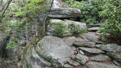 Stone Staircase |
Beacon Heights Trail(Milepost 305.2)
An incredible view and a great place for a picnic lunch. Reminiscent of Stone Mt Park in NC. The trail forks at the top, with the right hand fork leading to the bluff and the left hand side leading to a flatter area with a view of Grandfather Mt. (No pictures of Grandfather mountain this time as the low clouds had totally fogged it in.)
Linville Falls Trail(Milepost 316.4)
One of the most popular hikes in the area. While there is nothing bad about it, I would recommend many of the other hikes before this one. The main issue is that by the time to you reach Erwins view you are so far from the falls they lose much the impact. We had seen where someone had hiked down to the bottom of the falls and thought that would be a great view, but could not see how he got there.
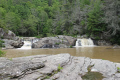 Upper Falls View |
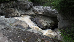 Upper Falls View |
 Chimney View |
 Erwins View |
 |
