
Just show me the Best Pictures The Best
Pictures and Descriptions. (Scroll Down)
I want to take this trip, what details should I know? Details and Trip Planning
“New Mexico?”, said Louise.
And now for something completely different. Or at least a major change of scenery for Louise and I. Looking at our travel map I noticed an appalling lack of pins for the southwest. Last year when I made a travel map of all of the National Parks I wanted to see I noticed there was a large group of them in the southwest. While none of the parks themselves seemed of interest to merit a special trip, there was a large group of them in New Mexico area. It seemed like there may be trip idea in there somewhere.
The first plan had us driving from the top of the state to the bottom, but everything out there is just a little farther than it looks, so I (thankfully) scaled back and found 4-5 sites that were within 1-2 hours from either Albuquerque or Santa Fe. I also remembered an old friend Christine was living in Albuquerque, so we now had a plan. Louise had a requirement that we have at least one down day and since we both were interested in a balloon ride, that was a no brainer as well. We found two nice hotels and split the trip between Albuquerque and Santa Fe to reduce our travel times.
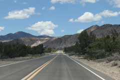
For anyone on the east coast I’d definitely recommend the trip. The scenery is just so different from anything here in the southeast. When we got back we were trying to think of anywhere near our house where you could be driving on the highway and see for 3 miles in the distance, much less the 9 miles we saw in New Mexico. One of the surprises of the trip was the high elevation. Albuquerque is at 5,300’ and Santa Fe is at 7,200’. I could recommend both resorts we stayed in for different reasons and all of the National Parks are worth seeing.
Bandelier National Monument
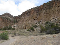
About 1 Million years ago one of the volcanoes in the area erupted coating the entire area with ash that was up to 1000’ feet deep. The Ash eventually formed into a very soft sedimentary rock call tuff that is about as hard as chalk and can be dug out with stone or wood tools. Between 400-700 years ago the site was in habited by native people who dug into the cliff sides to make houses.
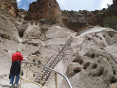
The Main Loop Trail is 1.2 miles round trip with about 50’ of elevation. Add another 1.0 mile if you want to add the Alcove House with its 4 ladders and 140’ of elevation.
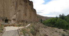
1. Main Loop Trail. You can just see people on the trail on the right.2. Looing down on the village. It is still unknown why some villages lived in the village and others in the caves.
3. Further along the Valley
4. Ladders to the Alcove House.
 1 |
 2 |
 3 |
 4 |
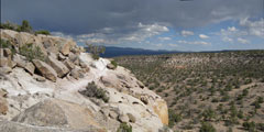
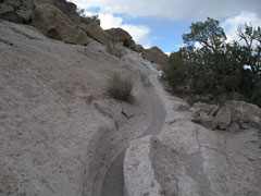
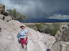
While still part of Bandelier National Monument, The Tsankawi section (Silent T) is about 12 miles from the main park. Thought to have been inhabited in the 1400’s the hike is up and around a medium size messa. I really enjoyed this one, and it had the extra advantage of being away from all crowds.
1. Some of the hike is not suggested for people with a fear of heights.2. View from the top of the Mesa.
3. The soft rock was 'carved' by the action of the people who lived here, just walking.
 1 |
 2 |
 3 |
 4 |
 5 |
 6 |
Los Alamos. To keep from seeing the same road twice and to get some lunch we thought we would make a loop by taking #501. A very interesting experience is to start seeing signs that say “your vehicle may be searched at any time” and have to stop at the guard gate. It seems that “New Mexico #501 is a state road in name only. It is not controlled or maintained by NMDOT. LANL/DOE performs all maintenance activities and controls the guard/check stations on the road and has the authority to take actions they deem necessary for the safety and protection of LANL/DOE property.” I think this translates to “we have plutonium here and we are going to stop you and ask questions if you want to drive though”
As for the town of Los Alamos itself, I’d skip it. For a population of about 12,000, I have no idea where they eat. After two loops around the city we say on a McDonalds, a Sonic, and a Bagel Café. Since the nearest city (Sante Fe) was an hour out, we had bagels. Wiki travel says it best “Los Alamos used to have a well-deserved reputation as a culinary wasteland” except the tense should indicated it still is.
Kasha-Katuwe Tent Rocks National Monument
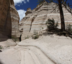
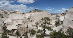
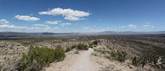
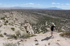
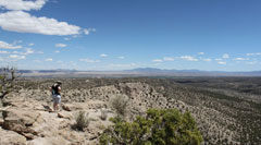
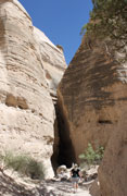
Another interesting rock formation made possible by softer volcanic sediment and erosion. This is more of a two part hike. If you hike both the Cave Loop Trail and the Canyon Trail its about 3.5 miles round trip. Staring from the Parking lot it’s a consistent uphill for the first 1.0 mile and a very steep 0.3 miles afterwards. The first half is an incredible hike through a narrow slot canyon which is only about 5’ wide at times but with 60-90’ walls. Incredible quite and you can’t hear another soul. The second half is a rather steep climb up the end of the canyon leading you to a ridge hike where you can see for miles and miles. This might not be for people with a serious fear of heights but fine if you just have a “concern for heights”.
 1 |
 2 |
 3 |
 4 |
 5 |
 6 |
 7 |
 8 |
 9 |
Balloning
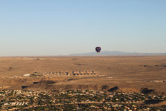
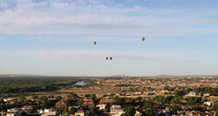
If your in Albuquerque, Ballon Rides are the thing. The famous “Albuquerque Box” refers to the strange winds they have. In the mornings when the air is still relatively still, the wind direction can change every 200’ or so. This allows you to ‘stee’ the balloon by climbing or descending until you catch some wind going in the direction you wanted. Our balloon pilot said that about 1/10 of the time he can land the balloon in the same parking lot that we took off on. In our case it was only about 4 blocks off. Not bad for an unpowered balloon.
 1 |
 2 |
 3 |
 4 |
 5 |
 6 |
El Malpais National Monument
Lava Flows. A string of volcanoes have added lava flows over a roughly 25x20 mile area over the past million years. About 3500 years ago the most recent flow covered nearly the entire park and given the lack of rain and erosion, you would think it was less than 10. A truly interesting hike compared to anything we have done before. Instead of sign posts they have cairns and it is very remote. We saw 1 person just leaving when we arrived and not a single person or sign of any other person or civilization on the hike. Nifty.
1. Lava Falls2. Lava Falls
3. Lava Falls
4. View from "The Narrows"
 1 |
 2 |
 3 |
 4 |
Sandia Crest
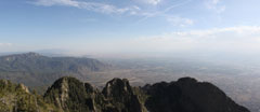
If your in Albuquerque you can’t miss the Sandia Mountains as they dominate the skyline. I’ve read there was great hiking but this one was kind of a bust. Maybe your millage may very . There are two main areas at the top of the mountain one at the top of the Tram and the other at the top of the Sandia Crest Road. We drove to the top of the road and I would not recommend. The road is 20 miles one way. There are no good hiking trails from the top, just a scenice view point and small 0.5 mile nature trail. Google maps list state road #165, but its an extremely narrow gravel road that looked more like a goat path so there is no way to make a nice loop out of the trip. Finally, given the way the crest faces it only has a good view of the city in the morning. So if you are going, go before noon. Also be aware that in May (and maybe other months) the constant wind kicks up so much dust that you have very poor views after the morning. The final insult was the national park service re-routed the old crest trail between the parking lot and the Tram so that it is no longer along the crest, and hence is through the forest and without any views. WTF?
If you plan to got anyway (maybe I missed something), I would suggest taking the Tram in the morning. At least that way you can have a beer at the top.
 1 |
